Summary: Latitude and Its Effect on Weather Patterns
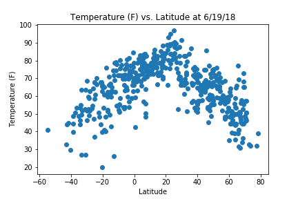
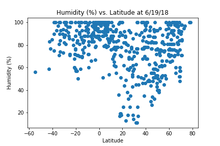
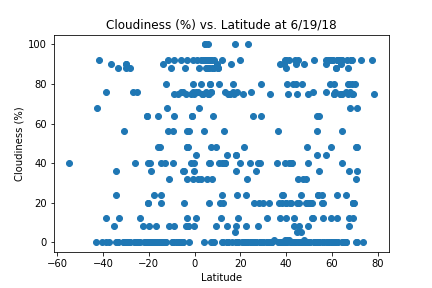
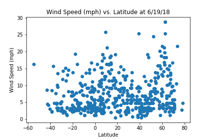
The purpose of this analysis was to identify trends in weather patterns as they relate to latitude. It was completed by randomly generating 500 possible values for both latitude and longitude. The Python library citypy was used to generate city names closest to the randomized latitude and longitude. Data was retrieved from the OpenWeatherMapAPI forecast data. Each point of interest, temperature, humidity, cloud cover, and wind speeed, was then plotted versus latitude for analysis.
Visualizations